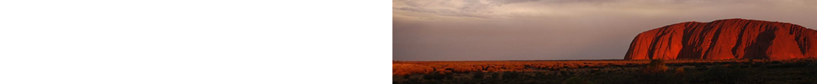

Because of the massive mountains that surround Glacier National Park, visitors inevitably compare it to Grand Teton. Perhaps the most significant difference is that here one drives among the mountain peaks; at Teton, you view the mountains from a distance, unless you're willing to head for the hiking trails.
Going-to-the-Sun Road is by far the most driver-friendly avenue on which to enjoy the park and see some of the more spectacular views. See the previous section, "If You Have Only 1 Day," for an idea of what you'll see along this road.
You can easily circumnavigate the lower half of the park in 1 long day, without traveling at warp speed. Along the way, you'll get a bird's-eye view of Big Sky country. After a leisurely breakfast in West Glacier, you'll be in East Glacier in plenty of time for lunch at the Glacier Park Lodge and at St. Mary or Many Glacier for dinner. (Note: Going-to-the-Sun Road's multiyear rehabilitation will cause 30-min.- to 4-hr. delays for several years.)
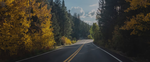
U.S. 2 between West Glacier and East Glacier, which is approximately 57 miles, is a well-paved, two-lane affair that winds circuitously around the western and southern edges of the park and follows the Middle Fork of the Flathead River. In the summertime, you'll see inner tubes and white-water rafts galore. As you descend to the valley floor, you'll drive through beautiful Montana ranchland and farmland. Shortly after entering the valley, look to the north and admire the park's massive peaks -- spires as beautiful as any on the planet. The Goat Lick parking lot, on U.S. 2 just east of Essex, gets you off the beaten path and provides a view into a canyon carved by the Flathead River; if you have time, take the short hike down to the stream and look on the hillside for mountain goats.
Beyond East Glacier, as you head northwest on Mont. 49 and west toward Two Medicine, you'll notice that the earth appears to fall off. The contrast is inescapable -- mountains tower in the west, but to the east the Hi-Line begins, with a horizon that extends far and flat. But round a corner on the Two Medicine Road, and suddenly you'll find yourself faced with three mountains (Appistocki Peak, Mt. Henry, and Bison Mountain), bare of vegetation, but as red as their Southwest counterparts. The difference here is that snow fills the crevasses, even in mid-August. Ten miles later, continuing the route north on U.S. 89, you'll come across a wide panorama of mountain peaks, valleys, ridges, and forested mountains that truly characterize Glacier's personality. Conclude the bottom half of your long loop by winding downward from these high elevations to the village of St. Mary. Not a bad day's drive!
There are two ways to see the park's western boundary and to reach the Polebridge area, in the north; one is slow and uncomfortable, the other slightly faster and less uncomfortable. The North Fork Road (Mont. 486) from Columbia Falls takes about an hour to negotiate. It's a sometimes-paved (often gravel- and pothole-filled) stretch that follows the North Fork of the Flathead River; spectacular views ameliorate the condition of the drive. Not much is there besides water and scenery, but the area around Polebridge is a popular spot for the outdoor crowd -- an excellent location to experience Montana's natural beauty.
The Inside North Fork Road, just north of Apgar, also runs to Polebridge. However, it's totally unpaved, takes an hour longer, and is much harder on driver, passenger, and equipment. Unless you are a glutton for punishment, take the faster route and spend that extra hour relaxing on a riverbank.
Note: This information was accurate when it was published, but can change without notice. Please be sure to confirm all rates and details directly with the companies in question before planning your trip.