

456km (283 miles) W of Williams Lake
Hwy. 20 cuts through a rugged land of lakes and mountains on its way to Bella Coola, a Native village on a Pacific inlet. This journey takes the adventurous driver from Williams Lake and the desert canyons of the Fraser River to glaciated peaks and finally to the shores of a narrow ocean fjord. It's an amazingly scenic trip, but be ready for lots of gravel roads and steep grades. There aren't a lot of facilities along the way, so start out with a full tank of gas. You can easily make this trip in a day, especially in summer, but leave plenty of time to stop and explore.
After climbing up out of the Fraser Canyon, Hwy. 20 winds along the Chilcotin Plateau, miles of spacious grasslands that are home to some of the largest ranches in North America. At Hanceville, the route drops onto the Chilcotin River, famed for its white-water rafting and kayaking. The Chilcotin Hotel, in Alexis Creek (tel. 250/394-4214), is a popular place to stop for a home-style meal. You can camp right on the river at Bull Canyon Provincial Parks, with 20 sites at C$14 apiece. The park is 10km (6 1/4 miles) west of Alexis Creek, 126km (78 miles) west of Williams Lake.
Just past Redstone, Hwy. 20 leaves the Chilcotin River and climbs up the valley. Puntzi Lake is home to a number of old-time fishing resorts. The Putzi Lake Resort (tel. 250/481-1176; www.puntzilake.com) has boat and tackle rentals, and rents campsites starting at C$15 and cabins or lodge rooms from C$50.
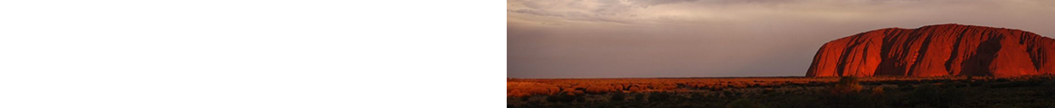
As Hwy. 20 presses closer to the Coast Mountains, the landscape is increasingly dotted with lakes and marshes. At the wee community of Tatla Lake, the pavement ends and the gravel begins. Anahim Lake, 328km (204 miles) west of Williams Lake and the largest settlement on the Chilcotin Plateau (pop. 522), is noted for its fishing and outdoor recreation. The Escott Bay Resort (tel. 888/380-8802 or 250/742-3233; www.escottbay.com) offers cabins starting at C$75. The general store in Anahim Lake is over a century old, and its coffeepot is always on. The enormous glaciated peak that dominates the southern skyline is Mount Waddington, which at 4,016m (13,176 ft.) is the highest point in the Coast Mountains.
As you begin the final ascent up to 1,494m (4,902-ft.) Heckman Pass, note the Rainbow Range, 2,400m-plus (7,874-ft.-plus) peaks that are brilliantly colored by purple, red, and yellow mineralization.
Thirty kilometers (19 miles) from Anahim Lake, Hwy. 20 crests Heckman Pass, and then begins "The Hill." Bella Coola residents had long dreamed of a road connection to the rest of the province, and a succession of provincial governments promised to build one from the Chilcotin Plateau down to the Pacific. When years went by and nothing happened -- civil engineers doubted that a safe road could be made down the steep western face of the Coast Mountains -- the locals took matters in their own hands. In 1953, two men in bulldozers set out, one from Heckman Pass, the other from the end of the road at the base of the Coast Mountains. In just 3 months, the two bulldozers kissed blades at the middle of the mountain, and Hwy. 20 was born. You'll feel your heart in your mouth on a number of occasions as you corkscrew your way down the road. The most notorious portion is 10km (6 1/4 miles) of gravel switchbacks, with gradients up to 18%, which drop 1,405m (4,610 ft.).
This part of Hwy. 20 passes through Tweedsmuir Provincial Park, British Columbia's second-largest park at 1 million hectares (2.5 million acres). This vast wilderness park of soaring mountains, interlocking lakes, and abundant wildlife is accessible by long-distance hiking trails, floatplane, and canoe. In fact, the Eutsuk Lake-Whitesail Lake circuit provides more than 320km (199 miles) of canoeing waters with just one portage. For information, contact BC Parks, 281 First Ave. N., Williams Lake (tel. 250/398-4414).
The town at the end of the road, Bella Coola (pop. 992), is a disorganized little burg in a green glacier-carved valley. Ancestral home to the Bella Coola tribe, Bella Coola once held a Hudson's Bay Company trading fort, then became a fishing center for Norwegian settlers. The waterfront is a busy place in summer, with fishing and pleasure boats coming and going.
Besides the lure of the end of the road, the main reason to drive to Bella Coola is to catch the BC Ferries Discovery Coast service. This summer-only ferry connects Bella Coola with other even more isolated coastal communities. The ferry terminates at Port Hardy, on Vancouver Island, making this an increasingly popular loop trip. The journey lasts 12 to 14 hours. In high season, fares between Port Hardy and Bella Coola are C$170 per adult passenger and C$340 for a car.