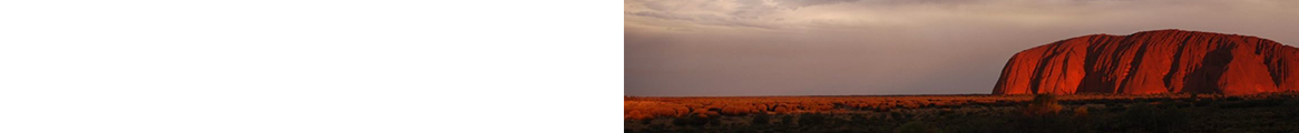
160km (99 miles) NE of Nairobi
Famous as the place where, in 1952, Elizabeth II learned that she had inherited the English throne, Aberdare National Park takes its name from a magnificent volcanic mountain range that forms part of the eastern wall of the Rift Valley. The Aberdare Mountains make up the backbone of the park and run for roughly 100km (63 miles) between Nairobi and the famed Thomson's Falls (where the waters of the Ewaso Narok River fall some 72m/236 ft.).
Topographically diverse, the park is cut through with deep ravines that make for splendid vistas -- wide valleys and vast slopes are carpeted by extremely dense forest and watered by icy, crystal-clear streams where trout fishing is possible. Covering 767 sq. km (299 sq. miles), the park ranges between two major peaks, Kinangop (3,905m/12,808 ft.) in the south and Ol Doinyo Satima (3,995m/13,104 ft.) to the north. Between these two summits stretch beautiful alpine moorlands that in places bear an uncanny resemblance to parts of the Scottish highlands, complete with bogs, spectacular waterfalls, and a salubrious clime. During the time of the Mau Mau uprising, freedom fighters took shelter in certain caves in these hills, spawning many modern local legends.
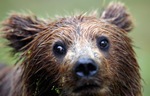
Even before independence, the park had earned a reputation for its famous Treetops hotel, where Elizabeth was staying when she became queen. Today there are two such "tree hotels," where guests find themselves ensconced in what feel like specially built gigantic viewing capsules, their sights poised on an endless array of animals that turn up -- like kids in a candy store -- to gorge on the mineral-rich salt licks that are constantly topped up by the hotels. For many, staying up all night and watching the nocturnal action from the viewing areas of these hotels is a Kenyan highlight; for others, it's like being on the wrong side of the cage at a zoo. Besides seeing large herds of African elephant and buffalo at close range, you might just glimpse one or two of the park's rare and endangered species, including black rhino (there are around seven in the entire park), giant forest hog, wild dog, and -- should hell freeze over -- bongo.
If you've made the effort to see the Aberdares and haven't managed to see rhino, you might also like to check out the fenced confines of the nearby Solio Game Reserve, a 6,868-hectare (16,964-acre) private sanctuary ranged between Mount Kenya and the Aberdares. With more than 200 black and white rhino, among other animals, it is considered Kenya's most successful rhino sanctuary, with the world's highest-density rhino population -- although without the sense of true wilderness that you'll find in the national park.
What's in a Name? -- Exotic as their name might sound, the Aberdares were christened by Victorian explorer Joseph Thomson, who first laid eyes on them in 1884 (while walking from Mombasa to Lake Victoria) and obligingly named them after the president of the Royal Geographic Society, Lord Aberdare. The Kikuyu people who have farmed the mountain slopes for centuries have a less sycophantic name for them -- Nyandarua, which means "The Drying Hide" and refers to the fact that, seen from a distance, they resemble an animal skin that's been stretched out to dry. They also call the mountains Thimbira (The Place of Gloomy Mist) and believe them to be an alternative resting place for N'gai (God), who usually inhabits Mount Kenya.